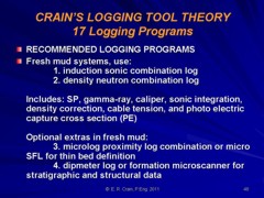
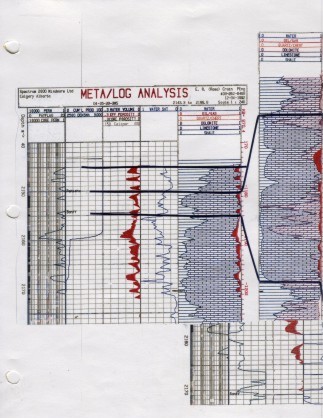
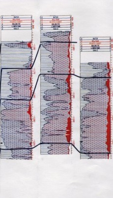
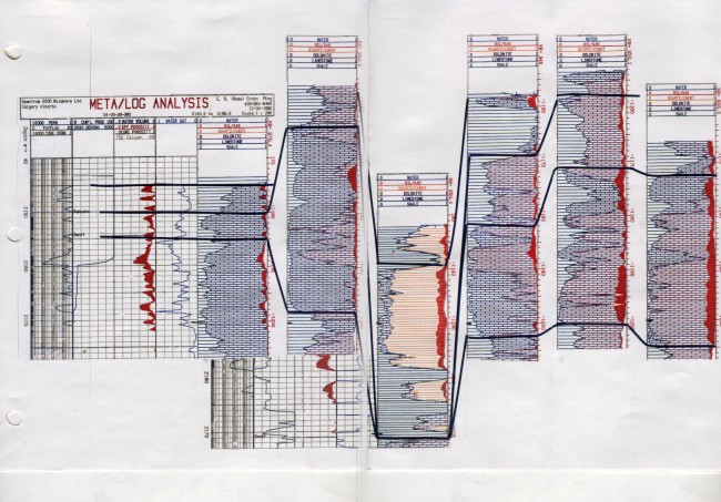
The pool was duly analyzed, pressure transient and decline curves were studied by the engineers, and meetings were held monthly for several years. But no agreement was reached. The operators in the west had better pressures and better production than those on the east. No one had a good answer as to why this should be so. After a while, the meetings fell off and people stopped talking about forming a unit. Several years later, the project was revived by different operators and the petrophysical job returned. I recognized the project immediately as some of our original work was in the well files. But more wells had been drilled, more pressures taken, and of course more oil had been produced. The objective was still to unitize the field. But the catching point was the newest well, drilled based on seismic attributes that suggested a higher than average porosity near the center of the field. But it was a sandstone channel incised into the carbonate. The east and west sides still appeared to be in separate pressure systems and the channel appeared to be in a third system. So there were three separate oil fields, not one large field. The channel had to be isolated from the east and west by shale, not seen on any logs. The original correlation between wells also could not predict the channel, and even with the new seismic, it was predicted as a higher porosity (which it was), but not as a sandstone channel bisecting the original field. Sample descriptions and log analysis lithology calculations solved a 10 year old mystery. My first logging job without supervision was in a similar environment about 20 miles south of this one. In those early days, we took the nearest offset well log from our "private" files to the job site. If the new logs looked something like the offset, we were home free. My new log was OK above a certain depth but below there was no similarity. Frantic radio-phone calls and a visit by the boss fixed it - it was "geology", not me, that was at fault. You can see why Integrated Petrophysics is so important. One science at a time will not solve very many problems.
|
|
||
|
Page Views ---- Since 01 Jan 2015
Copyright 2023 by Accessible Petrophysics Ltd. CPH Logo, "CPH", "CPH Gold Member", "CPH Platinum Member", "Crain's Rules", "Meta/Log", "Computer-Ready-Math", "Petro/Fusion Scripts" are Trademarks of the Author |
|||

|
||
| Site Navigation | CASE HISTORY INCISED SANDSTONE CHANNEL IN CARBONATE | Quick Links |